search
Brazil vegetation map
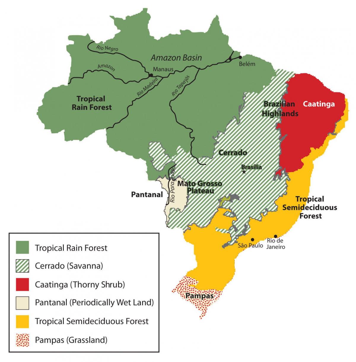
Map of Brazil vegetation. Brazil vegetation map (South America - Americas) to print. Brazil vegetation map (South America - Americas) to download. The variety of climates, soils, and drainage conditions in Brazil is reflected in the range of its vegetation types. The Amazon Basin and the areas of heavy rainfall along the Atlantic coast have tropical rain forest composed of broadleaf evergreen trees as its shown in Brazil vegetation map. The rain forest may contain as many as 3,000 species of flora and fauna within a 2.6-square-kilometre (1 sq mi) area. The Atlantic Forest is reputed to have even greater biological diversity than the Amazon rain forest, which, despite apparent homogeneity, contains many types of vegetation, from high canopy forest to bamboo groves.
In the semiarid Northeast, caatinga, a dry, thick, thorny vegetation, predominates. Most of central Brazil is covered with a woodland savanna, known as the cerrado (sparse scrub trees and drought-resistant grasses), which became an area of agricultural development after the mid-1970s. In the South (Sul), needle-leaved pinewoods (Paraná pine or araucaria) cover the highlands; grassland similar to the Argentine pampa covers the sea-level plains as its mentioned in Brazil vegetation map. The Mato Grosso swamplands (Pantanal Mato-grossense) is a Florida-sized plain in the western portion of the Center-West (Centro-Oeste). It is covered with tall grasses, bushes, and widely dispersed trees similar to those of the cerrado and is partly submerged during the rainy season.


