
search
Brazil states map
Brazil map with states. Brazil states map (South America - Americas) to print. Brazil states map (South America - Americas) to download. The Federative Republic of Brazil is a union of twenty-seven Federative Units (Portuguese: Unidades Federativas (UF)): twenty-six states as its shown in Brazil states map (estados; singular estado) and one federal district (Distrito Federal), where is located the federal capital, Brasília. The states are generally based on historical, conventional borders which have developed over time. The federal district is not a state in its own right, but shares some characteristics of a state and some of a municipality. The Federal District is bordered by the states of Goiás and Minas Gerais.
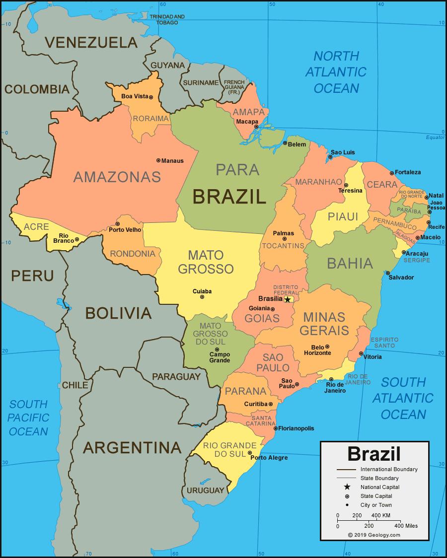
Administrative divisions of Brazil as its mentioned in Brazil states map: 26 states (estados, singular - estado) and 1 federal district (distrito federal): Acre, Alagoas, Amapa, Amazonas, Bahia, Ceara, Distrito Federal, Espirito Santo, Goias, Maranhao, Mato Grosso, Mato Grosso do Sul, Minas Gerais, Para, Paraiba, Parana, Pernambuco, Piaui, Rio de Janeiro, Rio Grande do Norte, Rio Grande do Sul, Rondonia, Roraima, Santa Catarina, Sao Paulo, Sergipe, Tocantins.
The federal, state, and local governments of Brazil obtained their respective autonomy from the 1988 Federative Pact. The 26 States and the federal district have their own constitution as you can see in Brazil states map. The 5 570 municipalities are not a creation of the states and are not governed by them as it is the case in most federations. They are granted the status of federal entities, at the same level as the states and are governed by an organic law, which must comply with federal and state constitutions. There is great discrepancy in the size (geographical area and population), and social and economic indicators among the subnational jurisdictions but all Brazilian municipalities enjoy the same legal status.