search
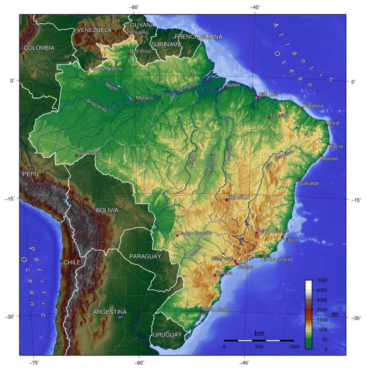
Brazil relief map
Relief map of Brazil. Brazil relief map (South America - Americas) to print. Brazil relief map (South America - Americas) to download. Brazil is a predominantly tropical country famous for its extensive Amazon lowlands; however, highlands cover most of the national territory. Brazil physical features can be grouped into five main physiographic divisions: the Guiana Highlands in the North, the Amazon lowlands, the Pantanal in the Central-West, the Brazilian Highlands (including the extensive coastal ranges), and the coastal lowlands as its shown in Brazil relief map.
Brazil shares the rugged Guiana Highlands with Venezuela, Guyana, Suriname, and French Guiana as its mentioned in Brazil relief map. The Amazon lowlands are widest along the eastern base of the Andes. The immense Pantanal, an extension of the Gran Chaco plain, is a region of swamps and marshes in northwestern Mato Grosso do Sul and southern Mato Grosso states and, to a lesser extent, in northern Paraguay and eastern Bolivia; it is one of the largest freshwater wetlands in the world, covering some 54,000 square miles (140,000 square km). The Brazilian Highlands make up more than half of the country landmass and are the main source of the nation abundant mineral wealth. The Atlantic lowlands, which comprise only a tiny part of Brazil territory, range up to 125 miles (200 km) wide in the North but become narrower in the Northeast and disappear in parts of the Southeast.


