
search
Brazil mountains map
Mountains in Brazil map. Brazil mountains map (South America - Americas) to print. Brazil mountains map (South America - Americas) to download. The principal mountain ranges average elevations just under 2,000 metres (6,562 ft) as its shown in Brazil mountains map. The Serra do Mar Range hugs the Atlantic coast, and the Serra do Espinhaço Range, the largest in area, extends through the south-central part of the country. The highest mountains are in the Tumucumaque, Pacaraima, and Imeri ranges, among others, which traverse the northern border with the Guianas and Venezuela.
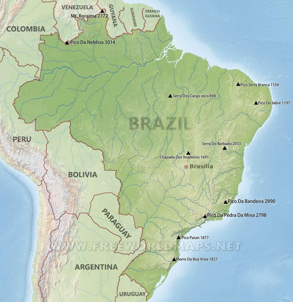
In addition to mountain ranges (about 0.5% of the country is above 1,200 m/3,937 ft), Brazil Central Highlands include a vast central plateau (Planalto Central). The plateau uneven terrain has an average elevation of 1,000 metres (3,281 ft) as its mentioned in Brazil mountains map. The rest of the territory is made up primarily of sedimentary basins, the largest of which is drained by the Amazon and its tributaries. Of the total territory, 41% averages less than 200 metres (656 ft) in elevation.