search
Brazil map regions
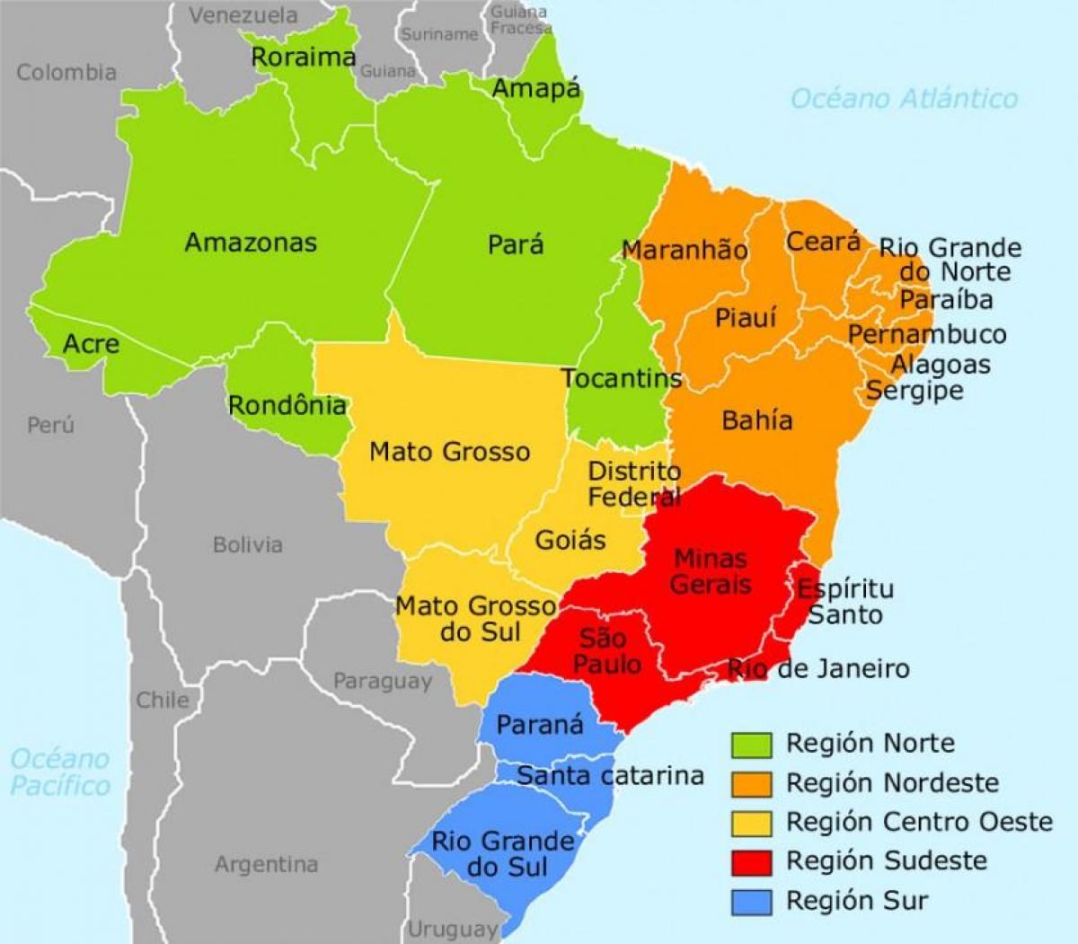
Brazil regions map. Brazil map regions (South America - Americas) to print. Brazil map regions (South America - Americas) to download. Brazil is divided into five regions (also called macroregions) by the Instituto Brasileiro de Geografia e Estatística (IBGE). These divisions are composed of states within them. The five regions of Brazil as its shown in Brazil map regions are: North Region, Northeast, Central-West, Southeast, South.
The Northern Region of Brazil as its mentioned in Brazil map regions is the largest Region of Brazil, corresponding to 45.27% of the national territory. The Northeast Region of Brazil is composed of the following states: Maranhão, Piauí, Ceará, Rio Grande do Norte, Paraíba, Pernambuco, Alagoas, Sergipe and Bahia, and it represents 18.26% of the Brazilian territory. The Central-West Region of Brazil is composed of the states of Goiás, Mato Grosso and Mato Grosso do Sul; along with Distrito Federal, where Brazil national capital, Brasília, is situated. The Southeast Region of Brazil is composed by the states of Espírito Santo, Minas Gerais, Rio de Janeiro and São Paulo. The South Region of Brazil is one of the five regions of Brazil. It includes the states of Paraná, Santa Catarina and Rio Grande do Sul and covers 576,409.6 km ², being the smallest portion of the country, occupying only about 5% of the territory of Brazil.


