search
Brazil climate map
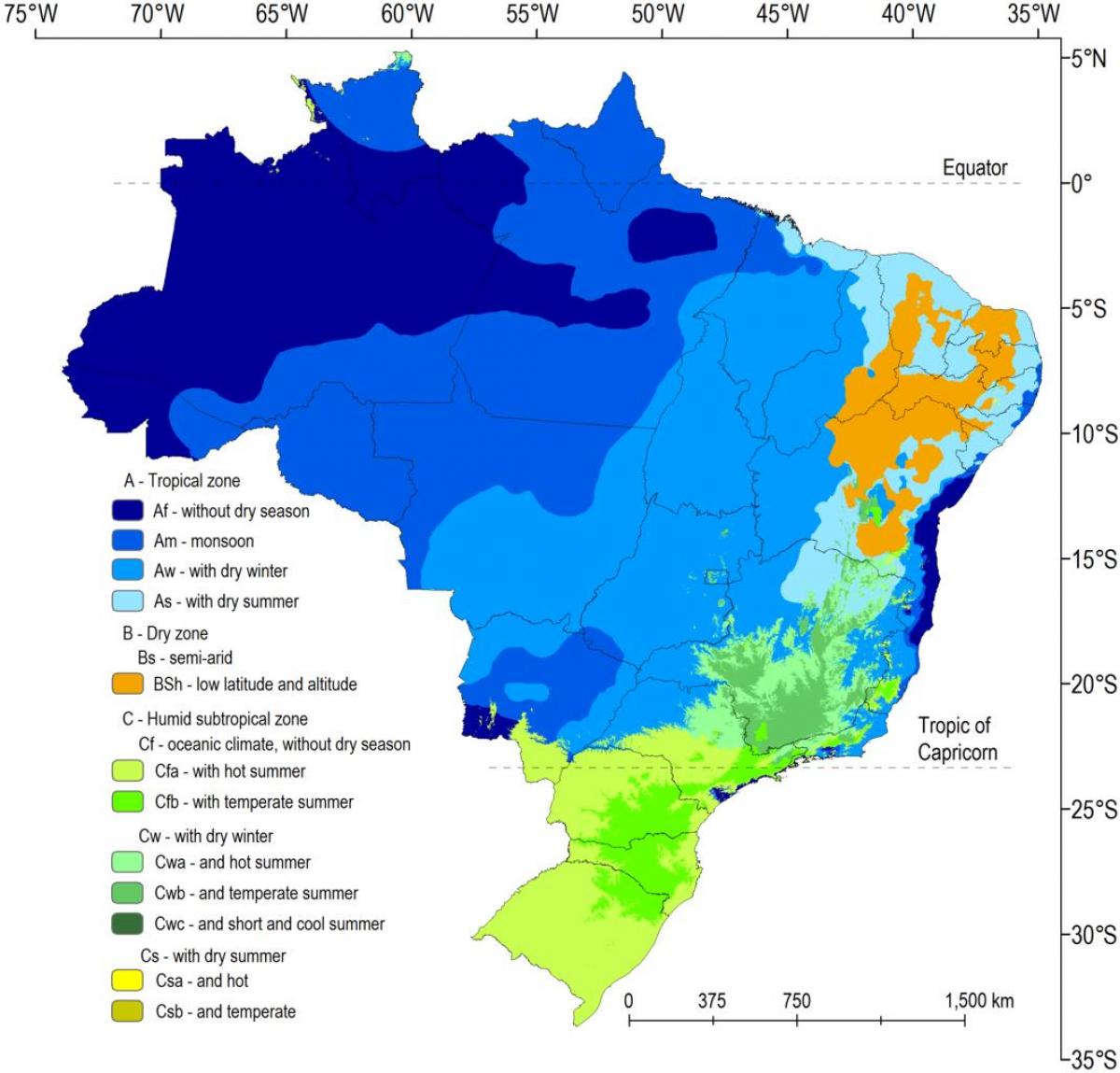
Climate map Brazil. Brazil climate map (South America - Americas) to print. Brazil climate map (South America - Americas) to download. The climate of Brazil comprises a wide range of weather conditions across a large area and varied topography, but most of the country is tropical as its shown in Brazil climate map. According to the Köppen system, Brazil hosts five major climatic subtypes: equatorial, tropical, semiarid, highland tropical, temperate, and subtropical. The different climatic conditions produce environments ranging from equatorial rainforests in the north and semiarid deserts in the northeast, to temperate coniferous forests in the south and tropical savannas in central Brazil. Many regions have starkly different microclimates.
An equatorial climate characterizes much of northern Brazil. There is no real dry season, but there are some variations in the period of the year when most rain falls as its mentioned in Brazil climate map. Temperatures average 25 °C (77 °F), with more significant temperature variation between night and day than between seasons. Over central Brazil rainfall is more seasonal, characteristic of a savanna climate. This region is as extensive as the Amazon basin but has a very different climate as it lies farther south at a higher altitude. In the interior northeast, seasonal rainfall is even more extreme.
The semiarid climatic region of Brazil generally receives less than 800 millimetres (31.5 in) of rain, most of which generally falls in a period of three to five months of the year and occasionally less than this, creating long periods of drought as you can see in Brazil climate map. Brazil 1877–78 Grande Seca (Great Drought), the most severe ever recorded in Brazil, caused approximately half a million deaths. The one from 1915 was devastating too. South of Bahia, near the coasts, and more southerly most of the state of São Paulo, the distribution of rainfall changes, with rain falling throughout the year.


