
search
Brazil topographic map
Topographic map Brazil. Brazil topographic map (South America - Americas) to print. Brazil topographic map (South America - Americas) to download. Brazilian topography is also diverse and includes hills, mountains, plains, highlands, and scrublands. Much of the terrain lies between 200 metres (660 ft) and 800 metres (2,600 ft) in elevation as its shown in Brazil topographic map. The main upland area occupies most of the southern half of the country.
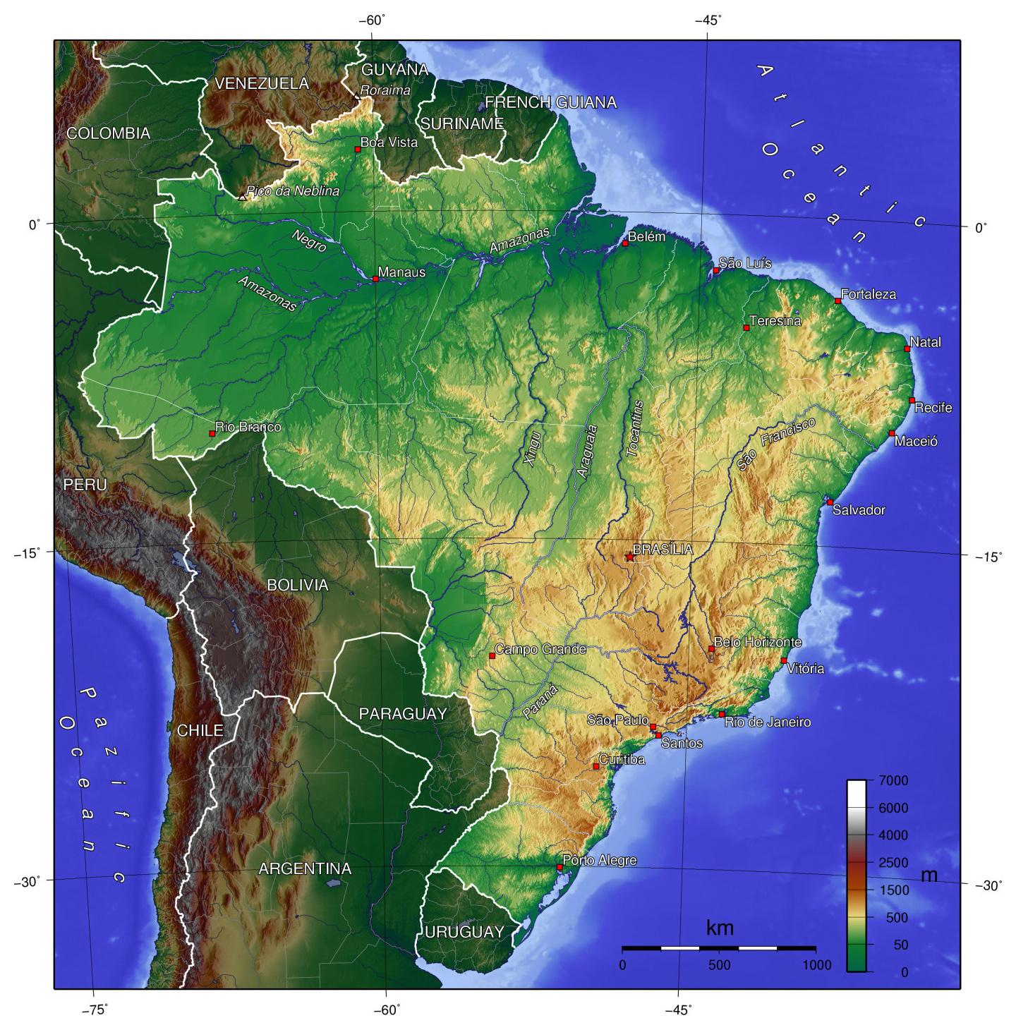
The northwestern parts of the Brazil plateau consist of broad, rolling terrain broken by low, rounded hills. The southeastern section is more rugged, with a complex mass of ridges and mountain ranges reaching elevations of up to 1,200 metres (3,900 ft) as its mentioned in Brazil topographic map. These ranges include the Mantiqueira and Espinhaço mountains and the Serra do Mar. In the north, the Guiana Highlands form a major drainage divide, separating rivers that flow south into the Amazon Basin from rivers that empty into the Orinoco River system, in Venezuela, to the north.