search
Brazil forests map
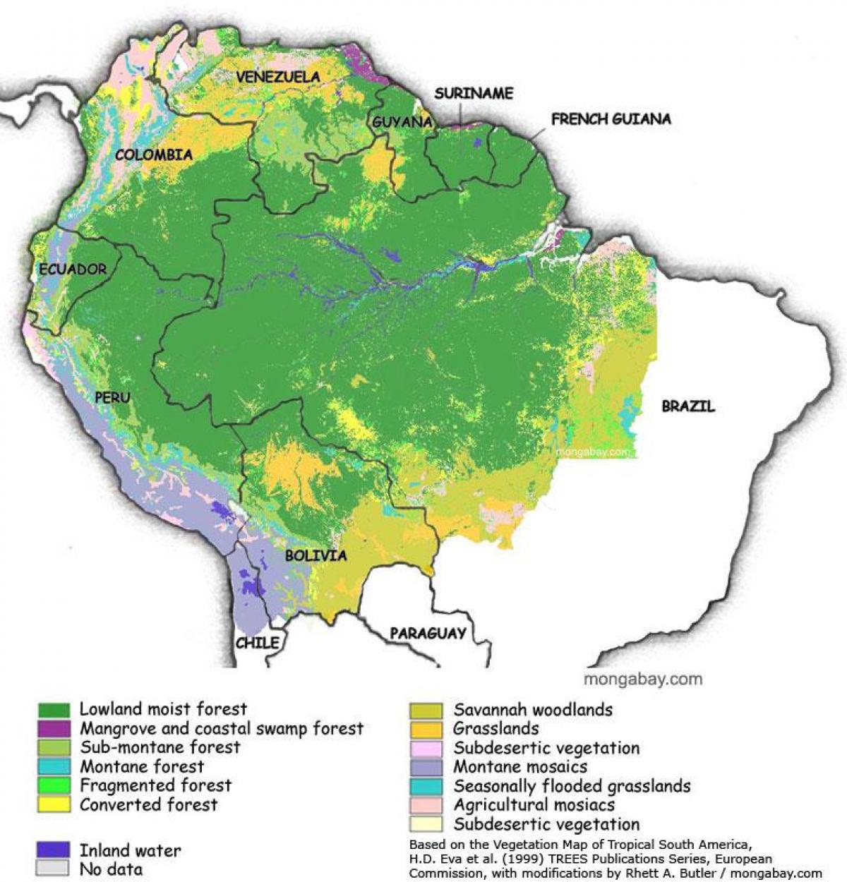
Map of Brazil forests. Brazil forests map (South America - Americas) to print. Brazil forests map (South America - Americas) to download. According to the U.N. FAO, 62.4% or about 519,522,000 ha of Brazil is forested, according to FAO as its shown in Brazil forests map. Brazil large territory comprises different ecosystems, such as the Amazon Rainforest, recognized as having the greatest biological diversity in the world, with the Atlantic Forest and the Cerrado, sustaining the greatest biodiversity. In the south, the Araucaria pine forest grows under temperate conditions. The rich wildlife of Brazil reflects the variety of natural habitats. Scientists estimate that the total number of plant and animal species in Brazil could approach four million.
The Atlantic Forest (Portuguese: Mata Atlântica) as its mentioned in Brazil forests map is a region of tropical and subtropical moist forest, tropical dry forest, tropical savanna, semi-deciduous forest and mangrove forests which extends along the Atlantic coast of Brazil from Rio Grande do Norte state in the north to Rio Grande do Sul state in the south, and inland as far as Paraguay and the Misiones Province of Argentina. The Cerrado, (Portuguese/Spanish for “closed”) is a vast tropical savanna ecoregion of Brazil, particularly in the states of Goiás and Minas Gerais. The second largest of Brazil major habitat types, after The Amazonia, the cerrado accounts for a full 21 percent of the country land area (extending marginally into Paraguay and Bolivia).


