search
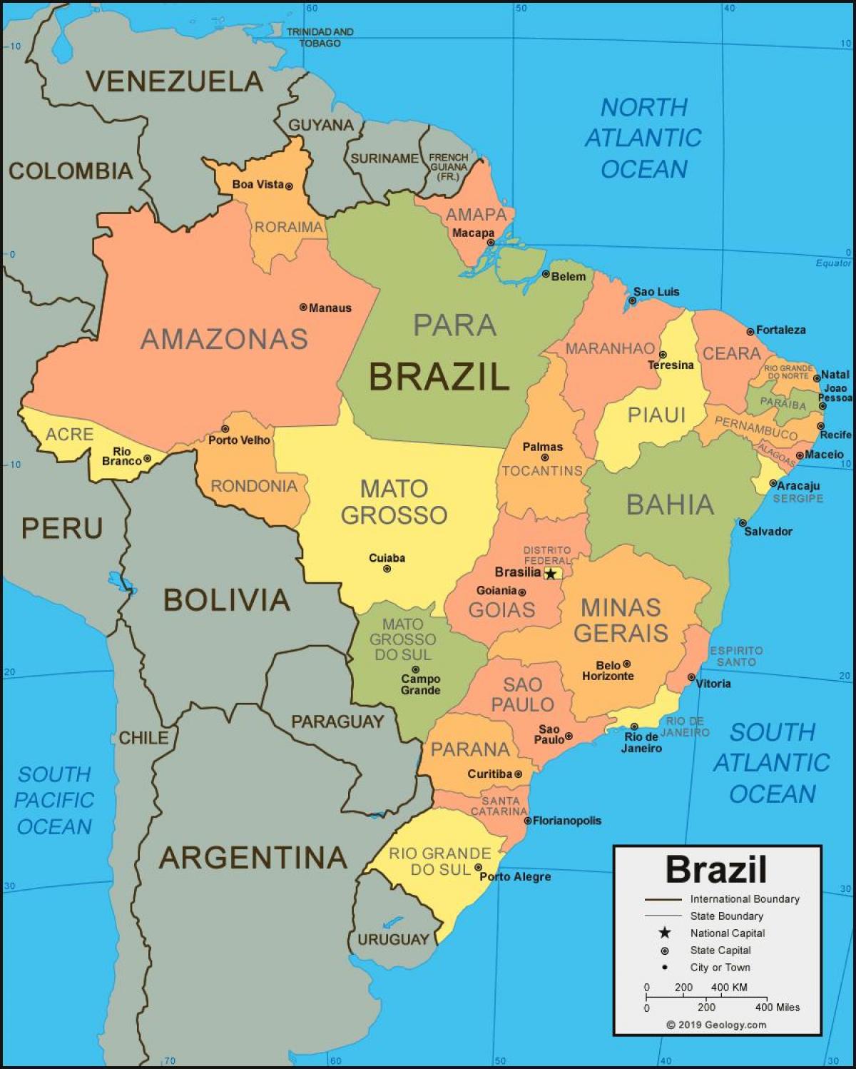
Brazil map with cities and states
Map of Brazil with cities and states. Brazil map with cities and states (South America - Americas) to print. Brazil map with cities and states (South America - Americas) to download. Brasilia is the capital of Brazil and Sao Paulo is the most populated city of Brazil. Brazil is divided into 26 states and 5,570 municipalities as its shown in Brazil map with cities and states. The state capitals are all the largest cities in their respective states, with the only exceptions being Florianópolis (which is the capital and the second largest city of Santa Catarina after Joinville) and Vitória (which is the capital but only the fourth-largest city of Espírito Santo, though it is located in that state's largest metropolitan area).
The map shows Brazil and the location of its 26 states and the one Federal district. List of Brazilian States (state capitals in parentheses) as its mentioned in Brazil map with cities and states: Acre (Rio Branco), Alagoas (Maceió), Amapá (Macapá), Amazonas (Manaus), Bahia (Salvador), Ceará (Fortaleza), Distrito Federal (Brasília), Espírito Santo (Vitória), Goiás (Goiânia), Maranhão (São Luís), Mato Grosso (Cuiabá), Mato Grosso do Sul (Campo Grande), Minas Gerais (Belo Horizonte), Pará (Belém), Paraíba (João Pessoa), Paraná (Curitiba), Pernambuco (Recife), Piauí (Teresina), Rio de Janeiro (Rio de Janeiro), Rio Grande do Norte (Natal), Rio Grande do Sul (Porto Alegre), Rondônia (Porto Velho), Roraima (Boa Vista), Santa Catarina (Florianópolis), São Paulo (São Paulo), Sergipe (Aracaju), Tocantins (Palmas).


