
search
Physical map of Brazil
Brazil physical map. Physical map of Brazil (South America - Americas) to print. Physical map of Brazil (South America - Americas) to download. Brazil physical features can be grouped into five main physiographic divisions as follow: the Guiana Highlands in the North, the Amazon lowlands, the Pantanal in the Central-West, the Brazilian Highlands (including the extensive coastal ranges), and the coastal lowlands as its shown in the physical map of Brazil.
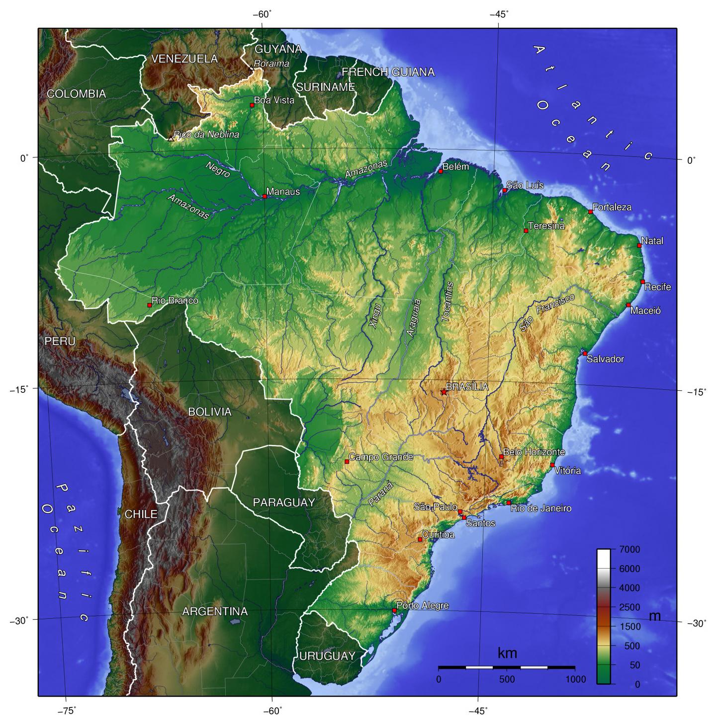
Brazil shares the rugged Guiana Highlands with Venezuela, Guyana, Suriname, and French Guiana. Forested mesas and mountain ranges, scenic waterfalls, and white-water rivers characterize the area as its mentioned in the physical map of Brazil. The Amazon lowlands are widest along the eastern base of the Andes. They narrow toward the east until, downstream of Manaus, only a narrow ribbon of annually flooded plains (várzeas) separates the Guiana Highlands to the north from the Brazilian Highlands to the south.
The greater part of the empire consists of an elevated plateau, having the mean elevation of from 300 to 1,000 metres, limited on the north and west by the great continental depressions of the Amazonas and Paraguay basins, which are almost united through the valley of the Madeira, and its tributary the Guapore as you can see in the physical map of Brazil. A portion of the elevated plateau of Guiana, nearly the whole of the great Amazonian depression, and the upper part of that of the Para-guay, are also included in the empire. In addition to these four grand natural physical divisions, there is also an Atlantic border-region, forming a narrow strip between the ocean and the eastern margin of the great continental plate.